Haweswater Area
20 April 2024
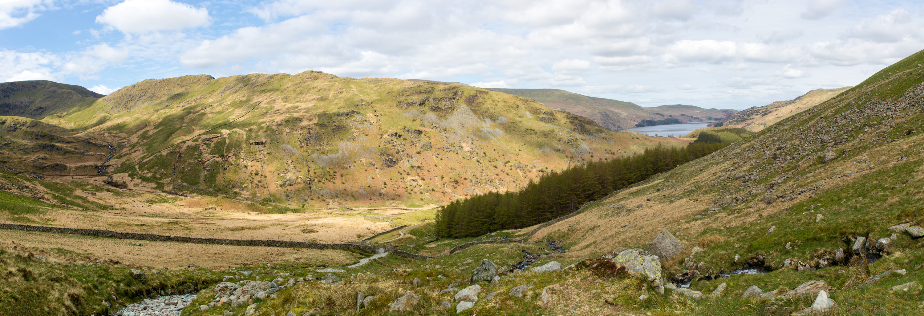
Hawes Water is shown in the top right of the above photograph. We climbed from there along the stony path shown in the bottom left.
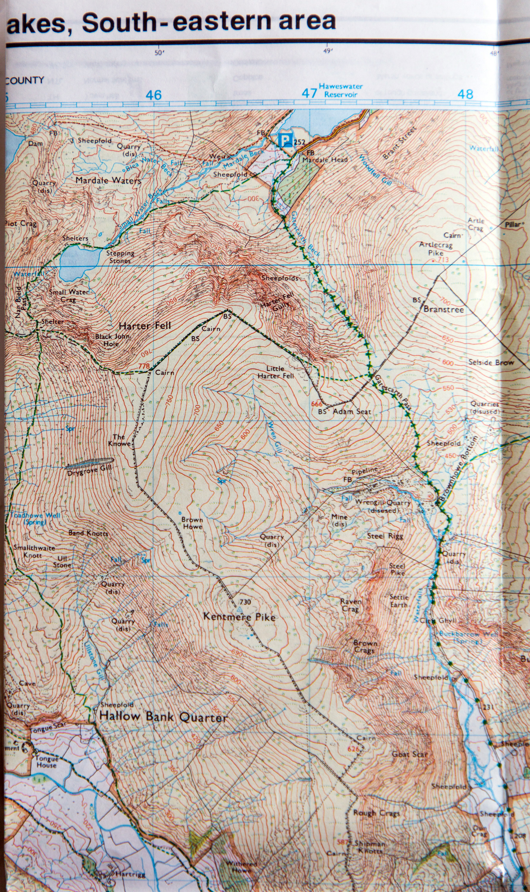
Map above courtesy of Ordnance Survey©
| The route we took for our walk started from the car park at the southern end of Hawes Water as shown at the top of the map above. From there, we walked along the route shown by the green marking by Mardale Head, following Gatescarth Pass until we reached almost to the junction of the path entitled Brownhowe Bottom. This involved a climb of about 500 metres in vertical height along a very stony path. |
 |
 |
 |